For the 200 years after Halifax was founded in 1749 as a British outpost, its fortifications were a reflection of the very fabric of its existence.
260 KB – 26 Pages
PAGE – 1 ============
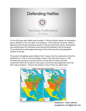
1 For the 200 years after Halifax was founded in 1749 as a British outpost, its fortifications were a reflection of the very fabric of its existence. Over these two centuries , Halifax defences went through successive periods of intense construction activity , interspersed with periods where the fortifications were ignored and allowed to fall into disrepair . They reflected the cutting edge technology of their times as well as the geopolitical si tuation of the day . The period I will address the construction of the first fortifications in 1749, to the end of Seven Years War with France in 1763. Of these early structures very little remains, as they were of timber and earth construction which did not last for many years, and the city has largely been built over their original locations. However the ghosts of a few of them can still be seen.
PAGE – 2 ============
2 On going conflict in North America stretched back to the early 1600s, as Britain and France vied for supremacy in the new world . Britain established its American Colonies along the Atlantic seaboard, in pink on the map above , while France settled New France , shown here in orange . F or a long time the frontier area in between in green here – was a contested no – , fought over between Britain and France and their respective Indigenous allies. France controlled present day Nova Scotia and had established a presence , with numerous Acadian settle ments throughout the region. A series of large and small wars took place during the 18 th century . However outside of these formal wars there was a constant , simmering hostility th at regularly boiled over into open conflict. It is i mmensely complicated , and I will attempt only to touch on some relevant events to provide context for the establishment of Halifax and its early defences . The t ime line here is to highlight some of the key conflicts and isolated events of the mid – 1700s , particularly in
PAGE – 3 ============
3 Britain captured Port Royal ( the North American theatre of the War of Spanish Succession) . This they renamed Annapolis, and built Fort Anne to defend it. The Treaty of Utrecht was signed in 1713 at the end of the War of Spanish Succession . Here, France ceded control of mainland Nova Scotia, Newfoundland and portion of to Britain, while retain ing all of the islands in the Gulf of St Lawrence (including Cape B reton, PEI) and the right to dry fish on south shore of Newfoundland. New Brunswick remained disputed territory. , encouraged and supported by France, continued to resist the British in the region an d skirmishes continued in NS as well as in N ew Brunswick/ Maine border area and in N ewfoundland , a p ortion of this being known as . In 1720, during the period after giving up mainland Nova Scotia to Britain, France established Fortress Louisburg to ex ert control over the Atlantic approaches to New France up the St Lawrence River the result of this ( along with the N ewfoundland fishing rights ) was continued friction between Britain and France , and heightened
PAGE – 4 ============
4 colonies over a French fortress presence on the Atlantic seaboard . Ongoing attempts by French, Acadians and native forces to capture Annapolis and Canso (the two British footholds in NS at that point) continued , a nd in 1745 British and American colonial forces capture d Louisburg . This occurred , which was the North American theatre of the War of Austrian Succession , running 1740 – 1748 ; at the end of which, in the Treaty of Aix – la – Chappelle , Cape Breton with Fortress Louisburg was returned to France (in exchange for Madras in India to Britain) this outraged the New Englanders , who had worked so hard to capture it 3 years previously. Britain then established Halifax the following year, in 1749 to strengthen her position in Nova Scotia, and to counter the re – established French stronghold at Louisburg. This brought Britain into more direct confrontation with the French Acadians in mainland , who continued to resist the British p resence in Nova Scotia throughout the next decade .
PAGE – 5 ============
5 War in Europe again erupted in 1756 with the start of the Seven Years War , during which, in 1758 Britain recapture d Fortress Louisburg (leading to taking Quebec and Montreal , and Britain gaining control of French Canada by the 1763 Treaty of Paris ) So, on to Halifax Early Defences f irst concern was to secure the settlement from attacks from local native and Acadian forces ( you will recall that Annapolis Royal and Canso had been subject to repeated attacks and sieges over the previous half – century, and there was still strong opposition to British expansion in the region) The i nitial plan was for 5 stockade forts connected by wooden p alisades in a ring around the town. These would be built using r ound wooden timbers about 10 feet long and 6 inches diameter sunk into the ground to form a fence – type structure.
PAGE – 6 ============
6 Th e map above from 1750 gives us two depictions of the settlement of Halifa x a plan (upper right) and a n oblique view of the town as seen from the top of a mast of one of the ship s anchored in the harbour (lower right). The masthead v iew offers an idea of the structure of the fortifications , while the p lan gives us an idea of where they were located although this map is believed to have been drawn before the forts were actually constructed , and is therefore not necessarily an accurate depiction of their locations .
PAGE – 8 ============
8 This map (below) , purported to be drawn by a French spy in 1755 , is likely a better representation of the actual positions of fortifications. Superimpose d on a current aerial view of Halifax , we are able to establish where the forts were probably located :
PAGE – 10 ============
10 By Sep tember 1749 the first fort near the top of Citadel Hill was completed, with another added the next month , along with a rough barricade of felled trees surrounding the settlement. By July the following year the felled tree barricade had been replaced by the palisade wall and remaining forts . The p alisade ran from up Salter Street the present Maritime Centre) which served as South G ate to town . Then to a salient just east of the old Memorial Library on Grafton Street, and Park Then it ran uphill to meet the Citadel Fort , roughly where the southern ra velin of the current Citadel is located. From there it ran across the eastern side of the current Citadel to meet Fort Luttrell, about where Rainnie Drive meets Gottingen Street (former Canadian Blood Services building). And lastly downhill to Grenadier Fort, roughly at the junction of former Jacob Street and Poplar Grove, now where the Delta Marriott Hotel/ Cogswell Tower located . The remaining palisade wall ran from there down to the waterfront at the foot of Jacob Street (now the middle of Cogswell in terchange).
PAGE – 11 ============
11 Above we have the image from the 1750 map view in the upper right, showing a depiction of the forts and palisades. The f orts would have consisted of a double row of palisades, with a square centre and a bastion at each corner to provide covering fire along the face of the forts and walls. Designed to withstand attacks from native and Acadian forces armed with hand weapons , they w ould have been about 200 x 200 feet overall , with musket loopholes in walls, and a barracks for 2 companies of soldiers (100 men). Trees and bushes were cleared for 30 feet outside the walls to offer a field of fire .
260 KB – 26 Pages